Archive
About
Works
Back
GatherRoute is a travel planning app idea that helps families and friends plan trips together using a physical map with AR. It makes the process more fun, visual, and easy for everyone to join in.
“Turn group travel into a shared experience.”
ROLE
Concept Development
AR Interface Design
Spatial Prototyping
TEAMMATE
Bryana Lee, Yi Wang
TOOL
Figma
TIMELINE
2025 — 7 weeks
IDEATION
Traveling Together
is Exciting
But group trip planning often feels stressful and unbalanced. One person does all the work while others feel left out. Tools are confusing and miss the fun of planning together. That’s when I wondered if planning could feel like part of the trip itself, something fun and inclusive for everyone.
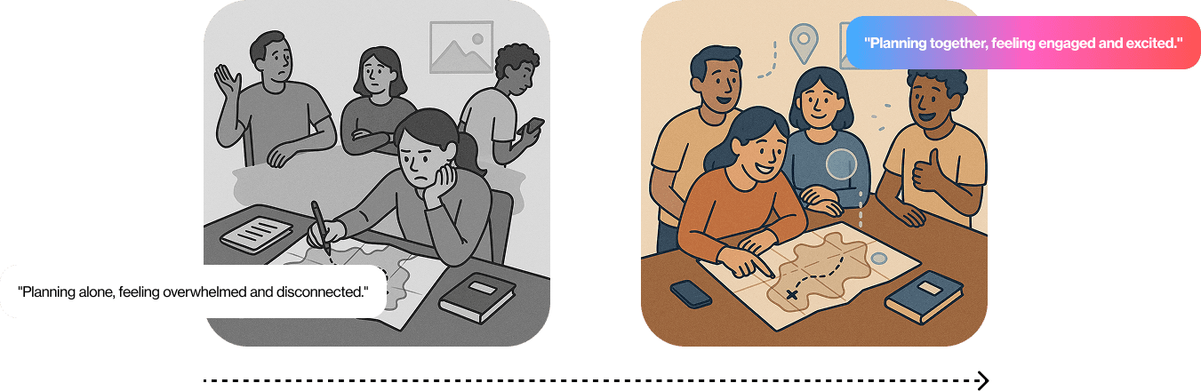
How might we make group trip planning feel fun, inclusive, and part of the travel experience?
RESEARCH
What Makes Group Planning So Hard
I interviewed families and friends of different ages to understand how they currently plan trips together and where things break down.
“If I could see where we’re going on a map, that’d help a lot.”
“It’s not really exciting until we actually go.”
“I just wait for someone to tell me what we’re doing.”
“My mom gets confused by all the apps. She prefers using a paper map.”
🤷♀️
Planning feels
one-sided
Most groups rely on one person to lead the planning, which makes others feel excluded.
🧩
Tools are too
complex
Many tools are complex and not designed to be intuitive or accessible for all age groups.
😐
Planning feels
one-sided
The process feels like a task, not something fun, shared, or easy for all to engage.
👀
Lack of shared
visibility
People want to see and understand plans, not just read through links, lists, or plain text updates.
Learning From
Hands-on Planning
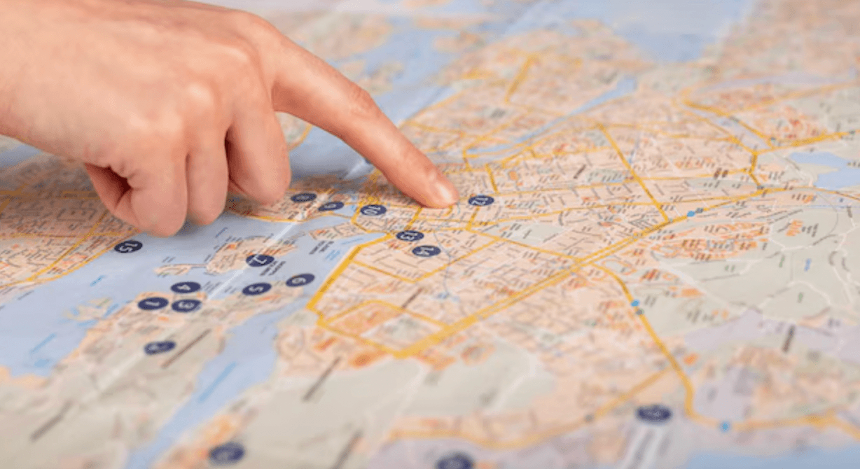
Interviews showed older users prefer printed maps. I observed families using physical maps, noting gestures like pointing and circling—revealing that tangible tools better support shared decisions than digital apps.
✅ Pointing to locations
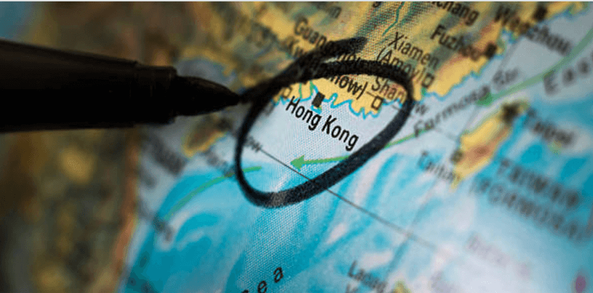
✅ Circling or placing objects to mark places
✅ Eye contact and gestures to discuss options
User Needs by
Planning Stage
After interviews and map interaction research, I visualized key findings to understand user needs and design for collaborative, multigenerational trip planning.
Trip Idea
Research
Choosing Places
Finalizing Plan
Sharing Details
A way to collect ideas easily
Tangible visuals, easy language
A visual, quick way to share ideas
Tools to compare options
Physical map or visual aids
Clear prioritizing system
Easy-to-use system to mark
A visual, quick way to share ideas
Confidence that everyone agrees
Summary or interactive map
Share itinerary and bookings
Mobile-friendly, visual recap
Make the starting point visible and shared by using a physical AR map as a conversation spark.
Create a low-effort, visual way for everyone to explore points of interest together.
Use tokens, gestures, or simple tools to make preferences visible without complex tools.
Build a shared map that reflects group decisions in real time so no one feels left out or uncertain.
Offer a mobile version of the itinerary so all generations can access and understand it.
DESIGN SOLUTION
Spaces for Play, Touch,
and Togetherness
Based on user insights and behavior patterns, I identified key design opportunities to improve the group trip planning experience. From these, I began ideating features and flows.
Trip Idea
Research
Choosing Places
Finalizing Plan
Sharing Details
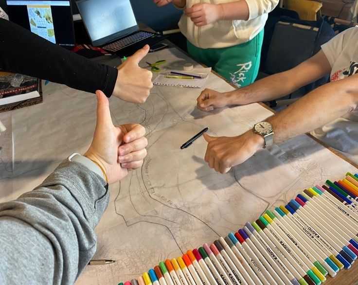
Each group selects a printed map of a specific city (e.g. LA) that aligns with their shared travel dream. The map acts as a physical starting point and planning hub.
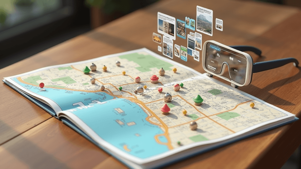
Families and friends physically gather around the map. Scanning it with AR glasses reveals interactive layers like local tips, hidden spots, and points of interest.
Each person contributes by placing tokens on the map, pointing at areas, or circling favorites. These physical gestures trigger AR overlays showing details.
As the group interacts, the system collects preferences and helps shape an itinerary that reflects everyone's input.
Once the plan is set, the updated itinerary can be saved digitally.
Design a collaborative tool that combines physical maps with AR to help groups explore and plan trips together with less stress and more engagement.
FINAL OUTCOME
Scan to Connect
Experiences
Users can scan physical tickets, QR codes, or location markers to instantly add destinations or events to the group trip plan—bridging physical moments with digital planning.
Explore & Bookmark
with Filters
Users browse the AR map using filters (e.g. food, attractions, stays) and bookmark locations of interest. Each person’s selections are visible to the group, helping shape a shared trip vision.
Live Trip Planning
Interface
The shared trip plan updates in real time as users place tokens or interact with the map. Everyone can see changes immediately, making it easy to align as a group.
Plan Details with
Time & Travel Info
Each pinned location includes editable time slots and estimated travel duration. This helps users organize daily schedules visually and understand how long it takes to move between stops.
NEXT STEP
From Concept
to Reality
User Testing: Prototype the physical map and AR overlays with families of different ages to gather feedback on usability and clarity.
Refinement: Improve the interaction system for placing tokens, triggering AR content, and syncing preferences across users.
Platform Integration: Explore how the system could sync with Airbnb or other travel apps for live booking and itinerary management.
Retail Strategy: Consider how these AR maps could be sold in travel shops, airports, or online as both planning tools and keepsakes.